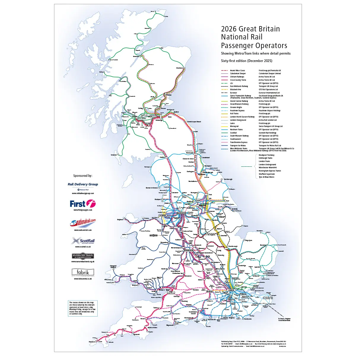

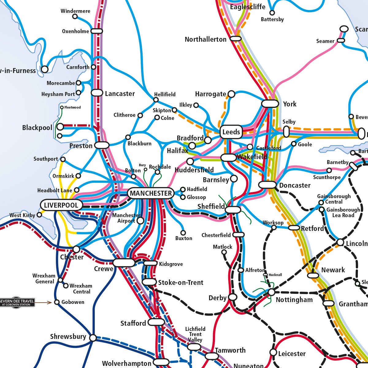
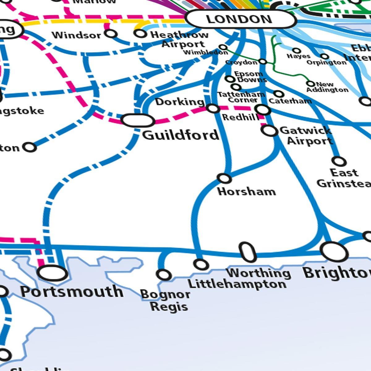
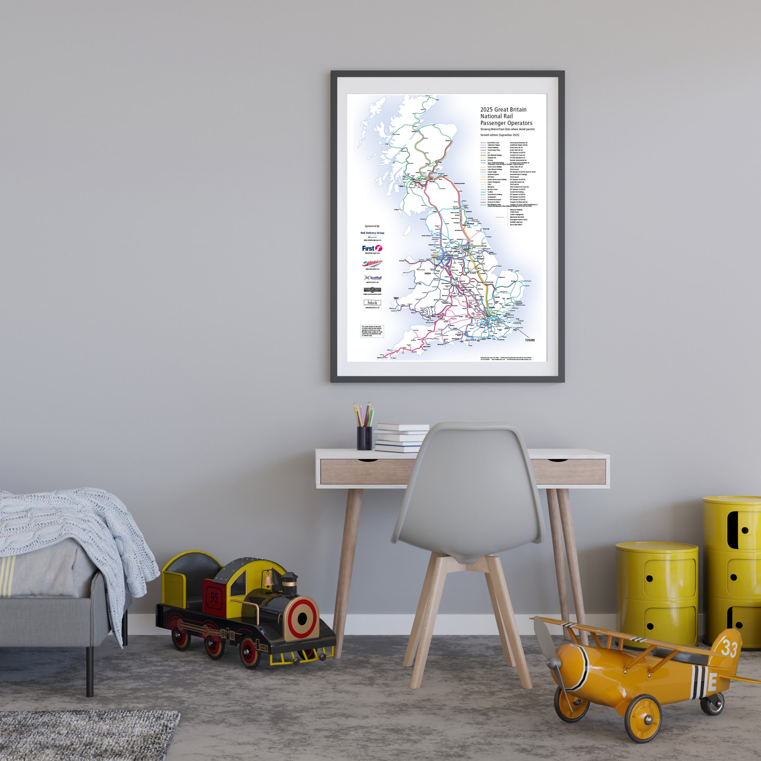
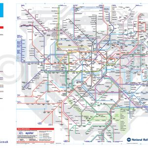
UK Railway Network Map 2026
Price range: £35.00 through £49.00
The UK Railway Network Map – Explore every UK train operator and tram network with the official 2026 National Rail Map – 62nd Edition. Essential for travellers, planners and rail enthusiasts. Updated April 2026.
Free UK shipping
- Satisfaction Guaranteed
- Printed on Demand
- Secure Payments
UK RAILWAY Network Map
The 2026 Great Britain National Rail Passenger Operators Map (62nd Edition) provides a clear and comprehensive overview of all National Rail passenger services across England, Scotland and Wales. Updated for April 2026, this UK Train Network Map includes:
All UK rail operators and their routes, from Avanti West Coast and ScotRail to Transport for Wales and Southeastern.
Key metro and tram networks where detail permits, including London Underground, Manchester Metrolink, Tyne & Wear Metro, Sheffield Supertram and Nottingham Express Transit.
Convenient connections to ports and airports, plus Eurostar services linking Britain to France, Belgium and the Netherlands.
A trusted resource for commuters, transport professionals, planners, and railway enthusiasts, giving a complete national picture at a glance.
This 62nd anniversary edition has been fully updated in collaboration with Fabrik Communications and endorsed by Barry Doe FCILT, ensuring accuracy and clarity. Whether you use it for journey planning, educational reference or display, the map remains the most reliable way to see how the UK’s rail network connects towns, cities and regions.
The UK Railway Network Map 2026 is printed to high standards and is a collectable reference and an indispensable tool for anyone with an interest in Britain’s railway network.
Latest Updates
- This version shows Lumo running from Stirling to London via the West Coast Main Line.
- There is a further delay to the opening of Bicester-Bletchley, with the service now merely expected to commence ‘during 2026’.
- There are several changes to the operator list, as more transfer to DFTO etc.
- Govia Thameslink changes its name to ‘Thameslink Southern Great Northern Limited’.
Product details
Experience art that feels silky to the touch with our high-quality, lighter-weight, classic semi-glossy paper:
Paper Finishing: Semi-glossy, enhances colours with a subtle shine.
Paper Weight: UK 260gsm, Non-UK 200gsm, sturdy and durable.
Sustainable Paper: FSC-certified or equivalent for sustainability.
No minimum order required. Printed and shipped on demand.
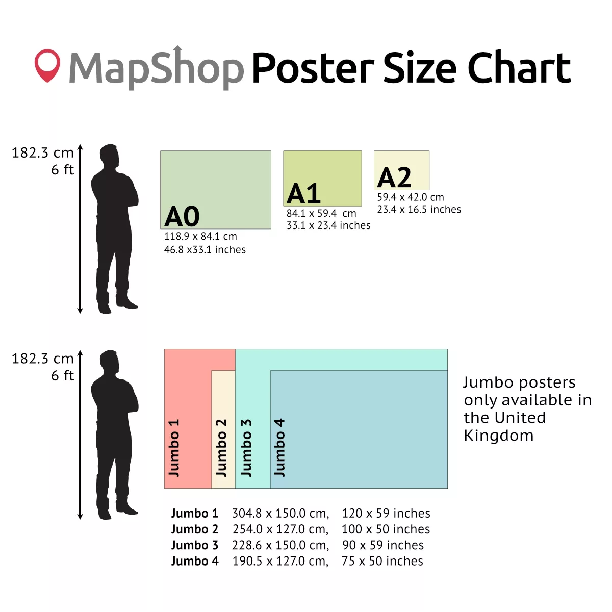
Sizes
| A0: Portrait, 841 mm (w) x 1189 mm (h), (33.1 in x 48.8 in) |
| A1: Portrait, 594 mm (w) x 841 mm (h), (23.4 in x 33.1 in) |
| A2: Portrait, 420 mm (w) x 594 mm (h), (16.5 in x 23.4 in) |
Need a simpler version? Check out our Overview Rail Network Map
Contact us for large sizes, as shown in the poster size graphics or for framed versions.
| Size | A3 – (420 x 297 mm) (16.5 x 11.7"), A2 – (594 x 420 mm) (23.4 x 16.5"), A1 – (841 x 594 mm) (33.1 x 23.4"), A0 – (1189 x 841 mm) (46.8 x 33.1") |
|---|
Only logged in customers who have purchased this product may leave a review.
You may also like…

Official TfL London’s Rail & Tube Services Map
Price range: £69.00 through £115.00Select options This product has multiple variants. The options may be chosen on the product pageUK Train Network Map (Overview)
Price range: £29.00 through £49.00Select options This product has multiple variants. The options may be chosen on the product page


")
Related products
UK Bus Registration Calendars for Operators & Planners
Price range: £40.00 through £49.00Select options This product has multiple variants. The options may be chosen on the product pageLondon Station Map Print – Choice of theme and frame colours
Price range: £39.44 through £79.36Select options This product has multiple variants. The options may be chosen on the product pageUK Geology Map – BGS Bedrock 625k Geological Wall Map Poster
Price range: £35.00 through £49.00Select options This product has multiple variants. The options may be chosen on the product page


&url=https://map-shop.co.uk/product/uk-railway-network-map-colour/&media=https://map-shop.co.uk/wp-content/uploads/2024/11/ms00004-uk-rail-map-a0-cmyk-726x1024.png)
Reviews
There are no reviews yet.