


Hobo-Dyer Equal Area Maps (Traditional)
Price range: £39.00 through £59.00
The Hobo-Dyer Equal-Area Maps, created to challenge traditional perspectives, accurately depict the relative sizes of countries and continents while questioning conventional North-South orientations. Developed by ODT, Inc., this projection builds on the Peters equal-area concept but is designed to reduce distortion in both the size and shape of landmasses, offering a more faithful representation than standard maps.
Commissioned in 2002 by Howard Bronstein (“Ho”) and Bob Abramms (“Bo”) of ODT, Inc., the map was skillfully drawn by Mick Dyer of Oxford Cartographers
Last updated by Oxford Cartographers: October 2024
Free UK shipping
- Satisfaction Guaranteed
- Printed on Demand
- Secure Payments
Hobo-Dyer Equal-Area Map Options:
Boundary
– Global
– India Specific
– China Specific
Orientation:
– South Up
– North Up
Meridian
– Greenwich
– Pacific Centred
Cartography:
– Simple
– Detailed
Language:
– English
– Portugues
– Spanish
– Mandarin
We also offer versions without title and footer information, contact us for more details.
The Hobo-Dyer Equal Area Projection Maps (Traditional Version) are an exceptional choice for educators, travellers, and anyone passionate about global understanding. Unlike traditional maps, this unique projection preserves accurate area proportions, making it ideal for those who value a realistic representation of our world. Below are the key benefits that make the Hobo-Dyer map an excellent addition to your home, office, or classroom.
1. True Representation of Land Area
The Hobo-Dyer map stands out by accurately representing land masses in their correct proportional sizes. Unlike the commonly used Mercator projection, which distorts the size of countries (e.g., making Greenland appear larger than Africa), this map provides a balanced view. Africa, South America, and other regions often downplayed in traditional maps are shown in their true dimensions, promoting a more equitable understanding of global geography.
2. Ideal for Education
Teachers and students can use the Hobo-Dyer projection to foster discussions about geography, colonialism, and cultural biases in cartography. The map challenges conventional worldviews and encourages critical thinking by presenting an alternative layout that prioritizes fairness and accuracy.
3. Customizable Orientation
Unlike most maps, the Hobo-Dyer projection can be rotated to place any region at the center, offering flexibility for various purposes. Want to emphasize the Global South? Rotate the map to highlight the southern hemisphere. This feature makes it perfect for addressing diverse audiences and contexts.
4. Visually Engaging Design
The symmetrical and aesthetically pleasing design of the Hobo-Dyer map makes it a striking addition to any space. Its bold yet accurate presentation invites exploration and sparks curiosity about the world.
Order your Hobo-Dyer Equal Area Projection Map today to embrace a more balanced and inclusive view of the planet!
5. Custom Version
Do you want something you can’t see here?
- Map without header or footer information or both
- Different colours
- Different fonts
- Elevation shading
- Custom symbols
- Hide country borders
- Different language
- Monochrome / Greyscale / Dark Mode
- Your locations marked
- Larger Poster size/Wallpaper
- Your logo
- Interactive web version
Complete the Hobo-Dyer enquiry form with your requirements and we will get back to you.
| Language | English, Portugues, Spanish, Mandarin |
|---|---|
| Orientation | South Pole Up, North Pole Up |
| Meridian | Greenwich, Pacific Centred |
| Cartography Level | Simple, Detailed |
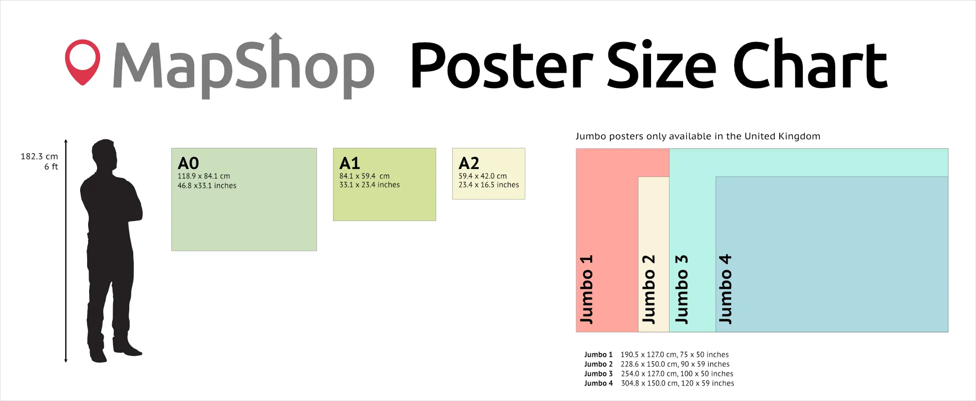
| Size | A2 – (594 x 420 mm) (23.4 x 16.5"), A1 – (841 x 594 mm) (33.1 x 23.4"), A0 – (1189 x 841 mm) (46.8 x 33.1") |
Only logged in customers who have purchased this product may leave a review.
You may also like…

Modified Gall World Projection Map (Political-Simple)
Price range: £39.00 through £59.00Select options This product has multiple variants. The options may be chosen on the product pagePeters Projection Map (Political-Simple)
Price range: £45.00 through £59.00Select options This product has multiple variants. The options may be chosen on the product page

")

 (simple)")
Related products
Hobo-Dyer Equal Area World Maps (Relief Version)
Price range: £39.00 through £59.00Select options This product has multiple variants. The options may be chosen on the product pageWorld Word Map (Light)
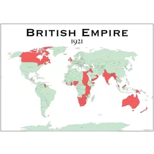
Price range: £23.68 through £48.72Select options This product has multiple variants. The options may be chosen on the product pageBritish Empire Map 1921
Price range: £29.00 through £49.00Select options This product has multiple variants. The options may be chosen on the product page
")


&url=https://map-shop.co.uk/product/hobo-dyer-equal-area-maps/&media=https://map-shop.co.uk/wp-content/uploads/2024/11/ms00005-hodo-dyer-en-spup-pacific-detailed-copyright-1024x701.jpg)
&url=https://map-shop.co.uk/product/modified-gall-world-projection-map-political-simple/&media=https://map-shop.co.uk/wp-content/uploads/2025/01/ms00007-gall-map-pol-simple-copyright-1024x724.jpg)
&url=https://map-shop.co.uk/product/peters-projection-map-political-simple/&media=https://map-shop.co.uk/wp-content/uploads/2024/10/ms00003-peters-map-simple-copyright.jpg)
&url=https://map-shop.co.uk/product/hobo-dyer-equal-area-world-maps-relief-version/&media=https://map-shop.co.uk/wp-content/uploads/2026/01/ms00009-hobo-dyer-relief-en-npup-modern-full-1024x724.webp)
&url=https://map-shop.co.uk/product/world-typography-light-a0/&media=https://map-shop.co.uk/wp-content/uploads/2024/11/ms01000-typographic-world-white-1024x727.png)
Reviews
There are no reviews yet.