
Caribbean Map and Main Islands
Price range: £35.00 through £49.00
The Caribbean Map provides a detailed political and physical map of the Caribbean, clearly displaying countries, islands, and geographical features. Ideal for educational, professional, or decorative use.
Free UK shipping
- Satisfaction Guaranteed
- Printed on Demand
- Secure Payments
Caribbean Map
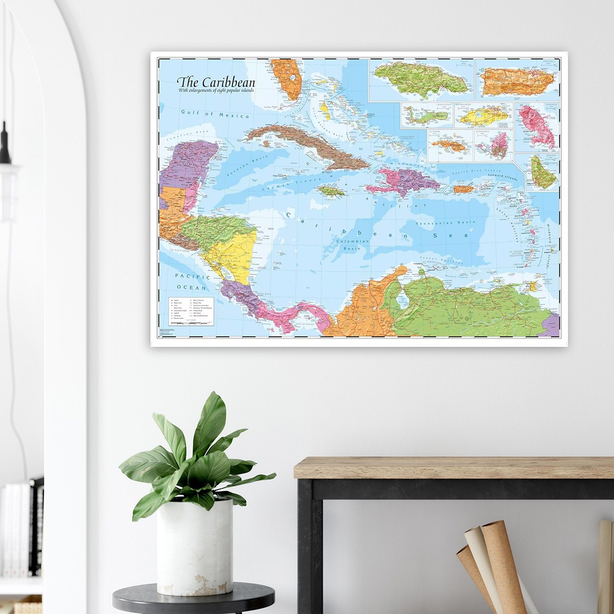
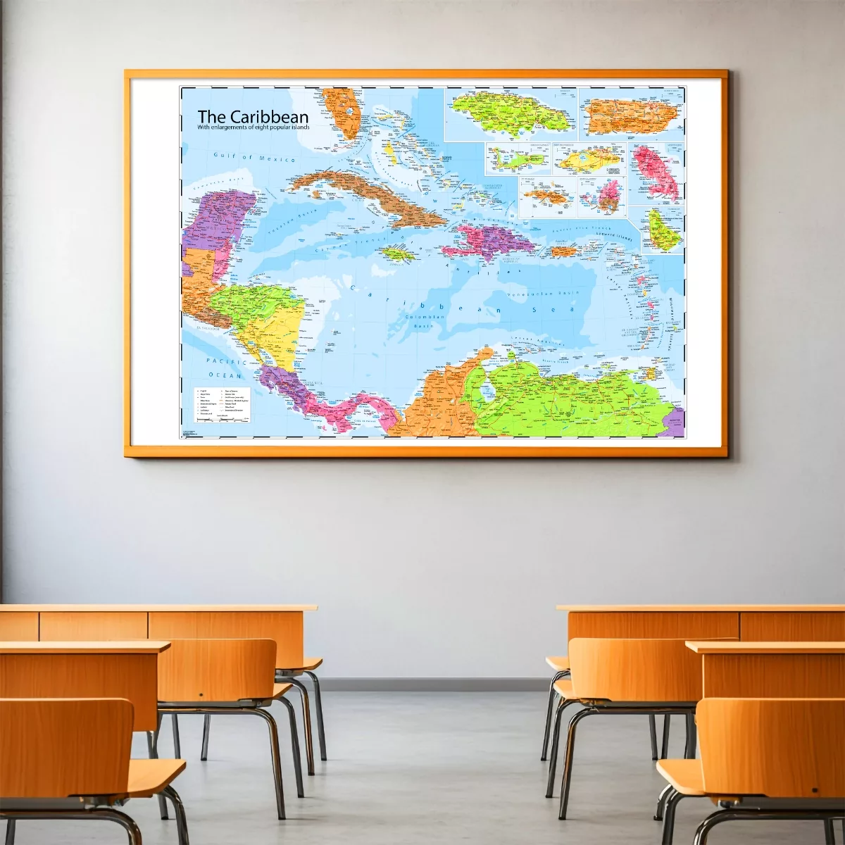
If you’ve ever wanted to trace island-hop routes, prep for a trip, or simply have a map worth stopping to look at, this is it. The Caribbean map by leading mapping company Oxford Cartographers combines detailed political boundaries with physical terrain across the entire Caribbean region, from the Gulf of Mexico and Central America to the Lesser Antilles and the Venezuelan coast.
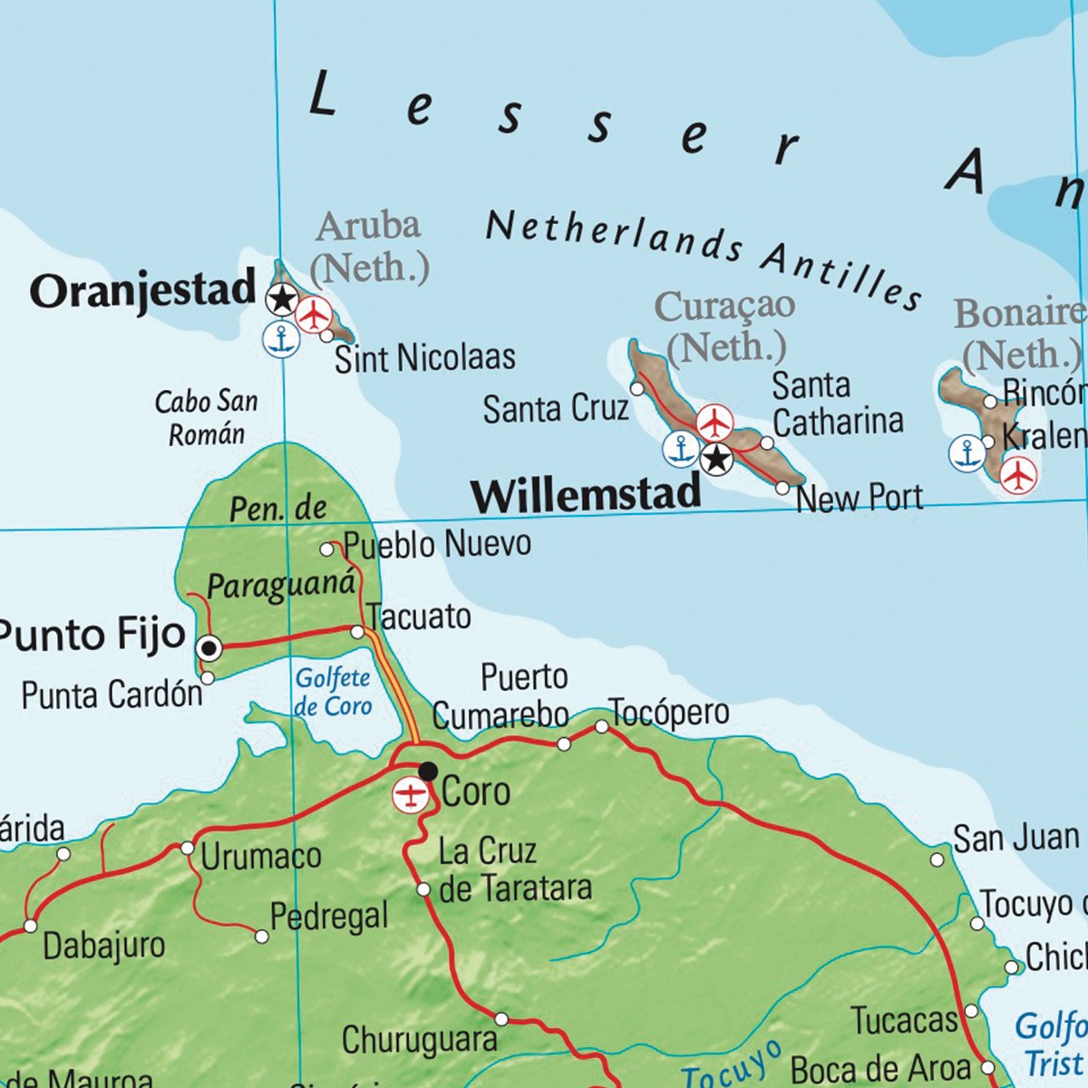
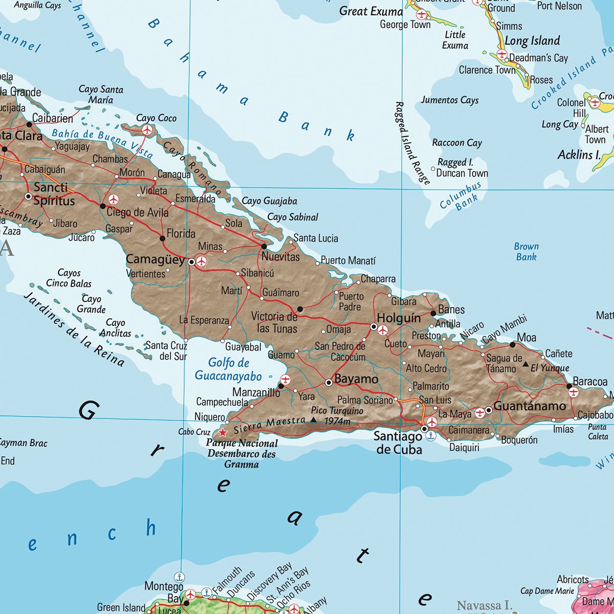
Countries, islands and territories are shown in distinct colours, making it easy to distinguish at a glance. Capitals, cities, towns and transport links are all clearly labelled, and relief shading alongside bathymetric detail brings the landscape to life, showing mountain ranges, coastal contours and sea depths in a way that a flat political map simply can’t.
Eight inset maps give enlarged views of the most visited islands, including Jamaica, Puerto Rico, Barbados and more, so you’re not squinting at a cluster of dots to find what you need.
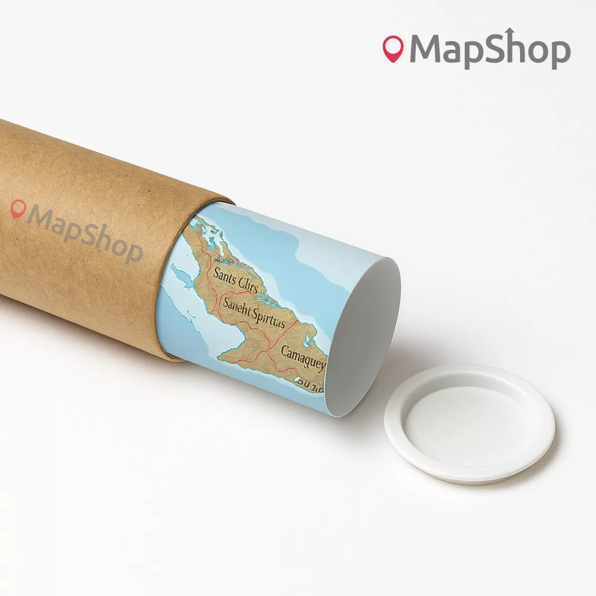
Printed to a high standard on quality stock, this unframed wall map works well in classrooms, offices, travel agencies, and home studies. It’s the sort of thing that earns its place on the wall and gets used.
Scale: 1:3,500,000
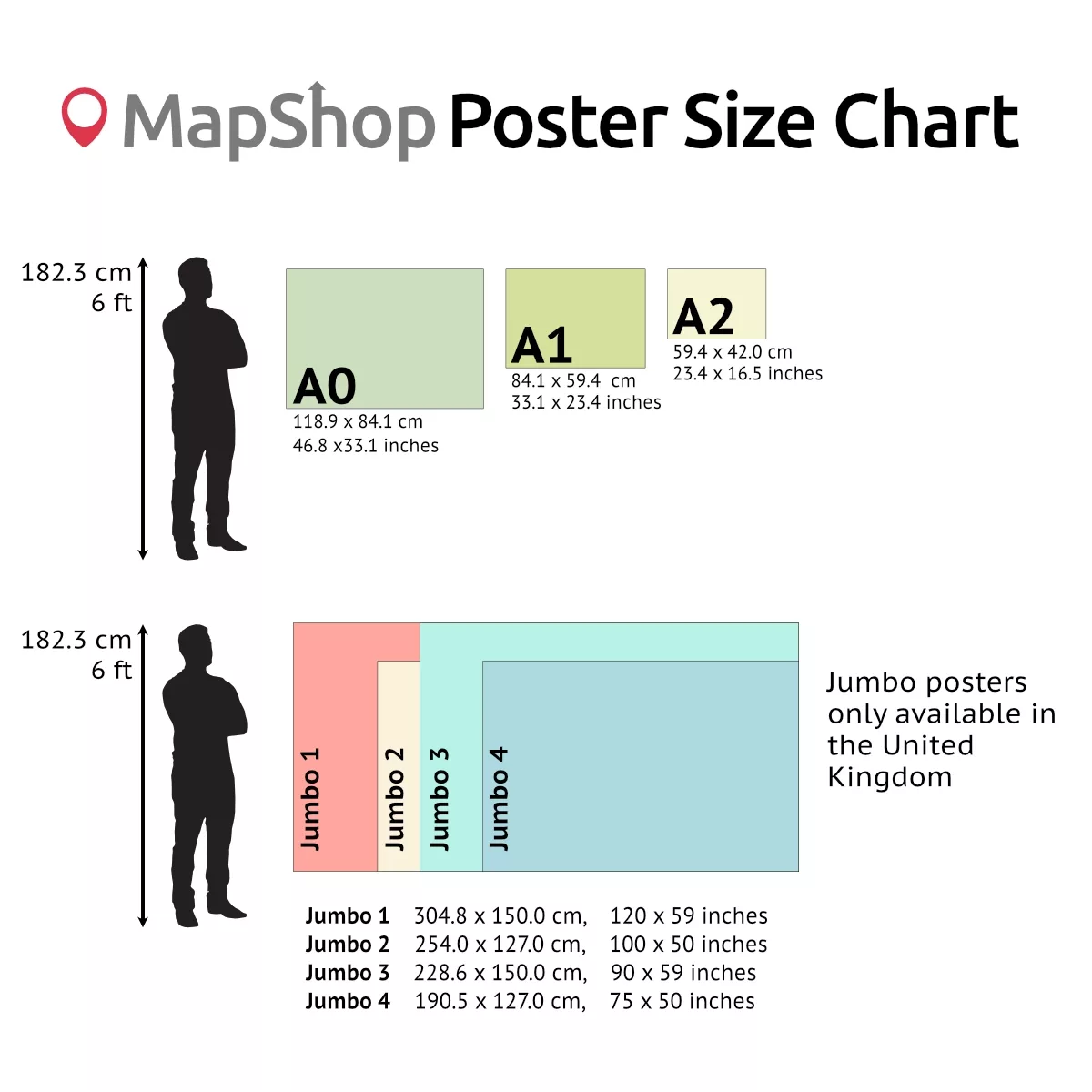
Sizes
| Format | Width x Height (in mm) | Width x Height (in cm) | Width x Height (in inches) |
| A0 | 1189 x 841 | 118.9 x 84.1 | 46.8 x 33.1 |
| A1 | 841 x 594 | 84.1 x 59.4 | 33.1 x 23.4 |
| A2 | 594 x 420 | 59.4 x 42.0 | 23.4 x 16.5 |
WHAT’S INCLUDED
- Political boundaries with colour-coded countries, islands and territories
- Physical terrain with relief shading and bathymetric sea depth detail
- Labelled capitals, cities, towns and transport networks
- Eight inset maps of popular islands, including Jamaica, Puerto Rico and Barbados
- Printed unframed, ready to mount or frame to your preference
IDEAL FOR
- Classrooms and geography teaching
- Travel planning and holiday research
- Offices, waiting rooms and professional spaces
- Home studies and living spaces
| Size | A2 – (594 x 420 mm) (23.4 x 16.5"), A1 – (841 x 594 mm) (33.1 x 23.4"), A0 – (1189 x 841 mm) (46.8 x 33.1") |
|---|---|
| Frame | Black, Dark Wood, White, Wood |
Only logged in customers who have purchased this product may leave a review.
Related products

Modified Gall World Projection Map (Political-Simple)
Price range: £39.00 through £59.00Select options This product has multiple variants. The options may be chosen on the product pagePhysical Map of Europe
Price range: £39.00 through £49.00Select options This product has multiple variants. The options may be chosen on the product pagePeters Projection Map (Political-Simple)
Price range: £45.00 through £59.00Select options This product has multiple variants. The options may be chosen on the product page

")


 (simple)")
&url=https://map-shop.co.uk/product/modified-gall-world-projection-map-political-simple/&media=https://map-shop.co.uk/wp-content/uploads/2025/01/ms00007-gall-map-pol-simple-copyright-1024x724.jpg)
&url=https://map-shop.co.uk/product/peters-projection-map-political-simple/&media=https://map-shop.co.uk/wp-content/uploads/2024/10/ms00003-peters-map-simple-copyright.jpg)
Reviews
There are no reviews yet.