Equal Earth Projection Maps | UN-Backed

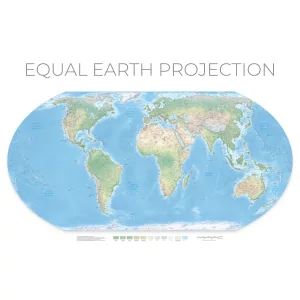
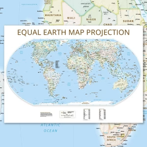
An Equal Earth projection map shows every country at its true relative size, and in September 2026 the UN General Assembly voted to encourage its use in place of the old Mercator map. Choose a political edition with borders and capitals, or a physical edition showing the natural world, both printed on satin finish paper.

Why choose an Equal Earth projection map?

Most of us learnt geography from a Mercator map, which was designed in 1569 for ships rather than classrooms. It keeps compass bearings correct but stretches land more and more towards the poles, so Greenland looks roughly the size of Africa when Africa is actually around 14 times bigger. An Equal Earth projection map fixes that, keeping every area in proportion while still looking natural and easy to read.

The UN vote and the Equal Earth projection

On 4 September 2026 the UN General Assembly adopted the “Correct the Map” resolution by 164 votes to 1. Introduced by Togo on behalf of the African Group, it asks governments, schools and international organisations to use Equal Earth and other equal-area maps wherever the size of places matters. The African Union had already endorsed the projection in August 2025. Every map in this range is drawn on Equal Earth, so it reflects the view of the world the UN is now encouraging.

Political or physical Equal Earth projection map?

Our political edition shows countries, borders and capitals, with more than 2,600 place names, and is available in 14 languages. The physical edition leaves the politics aside and focuses on the landscape, and comes in English, French or German. Both are printed on demand on satin finish paper, sent rolled in a sturdy tube and supplied unframed.

Equal Earth map FAQs:

Is this the world map the UN adopted?

The UN didn’t adopt a specific printed map. It backed the Equal Earth projection, which is the method used to flatten the globe onto a page, and encouraged its use where relative size matters. Our maps are drawn on that projection.

How is Equal Earth different from Mercator?

Mercator keeps shapes and directions accurate for navigation but badly inflates areas near the poles. Equal Earth keeps every country’s area in true proportion, so Africa, South America and South Asia appear at their real size.

What sizes are available?
The political map comes in 1000 x 700mm. The physical map comes in A1 (841 x 594mm) and A0 (1189 x 841mm).

Are the maps framed?
No, they’re supplied unframed, rolled in a protective tube, so you can choose a frame to suit your space.

Showing all 2 results

  • Equal Earth Wall Map (Physical) to Pinterest (opens in a new window)
    Equal Earth Physical Map ProjectionEqual Earth Physical Map Projection

    Equal Earth Wall Map (Physical)

    Price range: £65.00 through £75.00

    Our Equal Earth physical map shows the landscape of the whole planet with every continent at its true relative size, using the projection the UN General Assembly voted to encourage in September 2026. Available in A1 or A0 on satin finish paper, in English, French or German.

    Select optionsLoading Done This product has multiple variants. The options may be chosen on the product page
  • Equal Earth Wall Map (Political) to Pinterest (opens in a new window)
    Equal Earth Wall MapEqual Earth Projection Map

    Equal Earth Wall Map (Political)

    £75.00

    Our Equal Earth wall map shows every country and continent at its true relative size, using the projection the UN General Assembly voted to encourage in September 2026. The political edition has clear borders, capitals and more than 2,600 place names, printed at 1000 x 700mm on satin finish paper.

    Select optionsLoading Done This product has multiple variants. The options may be chosen on the product page