
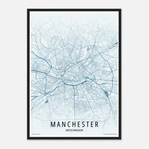
£39.44 – £79.36Price range: £39.44 through £79.36Custom city map print of any city or town in the world. Clean modern styling, multiple colour themes and available in A4, A3 and A2 sizes.
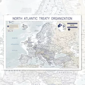
£29.00 – £49.00Price range: £29.00 through £49.00This NATO map shows all 32 member states of the North Atlantic Treaty Organization, updated to March 2024 and including Finland and Sweden. Available as a large format wall map poster in A0, A1 and A2, printed on satin paper and supplied by MapShop.
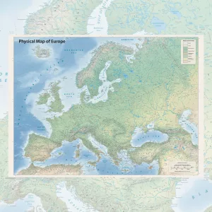
£39.00 – £49.00Price range: £39.00 through £49.00This physical map of Europe is a richly detailed poster showing the continent’s natural landscape in full. Rivers, mountain ranges, seas, coastlines and land cover types are all clearly mapped, from the tundra of northern Scandinavia to the deserts of North Africa. Printed in high quality on heavyweight paper, it is available in A2, A1 and A0 sizes to suit any space. Whether you are furnishing a home, a study or an office, this is a map that earns a second look every time you pass it.


